Land Navigation Without GPS: A Map and Compass System That Works
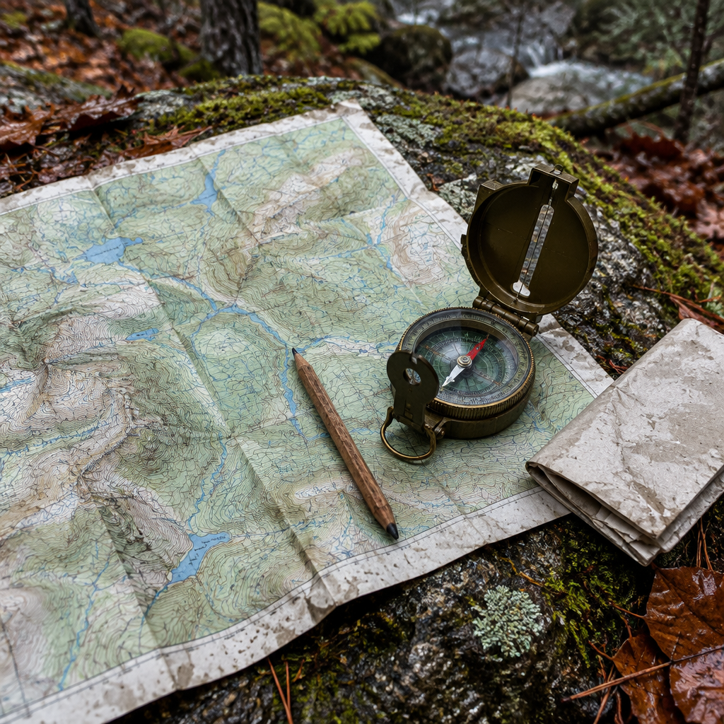
Every year, search and rescue teams respond to thousands of calls from people who were never more than a few miles from a road. The phone had bars. The map app had a blue dot. Then the battery died, or the trail bent where the screen did not, and the blue dot was the only thing they knew how to read. Land navigation without GPS is not a skill for purists. It is the difference between walking out at dusk and an unplanned night out.
This guide covers the practical system: a paper map, a baseplate compass, and the habits that make them work. No batteries, no signal, no subscription.
What Actually Fails When GPS Fails
Start by correcting a common misunderstanding, because it changes how you plan. A phone's GPS receiver does not need cell service to fix your position. It listens to satellites. What needs service is downloading map tiles, so a phone with offline maps saved will still show your position in airplane mode.
The real failure points are more mundane and more likely:
- Battery. Cold drains lithium cells fast, and navigation apps with the screen on drain them faster. A dead phone is the most common way people lose electronic navigation.
- Damage. A cracked screen, a drop in a creek, or a swollen battery ends the tool permanently.
- Interference. GPS jamming and spoofing are documented and growing problems, particularly near conflict zones and some industrial areas, and aviation and maritime authorities issue regular advisories about them. The system is more fragile than the blue dot implies.
- Terrain. Canyons, dense canopy, and steep north-facing slopes block sky view. The receiver is fine; it simply cannot see enough satellites to triangulate.
FEMA's core preparedness guidance has always included a physical plan for how a household reunites when normal systems fail. Navigation deserves the same treatment: a paper backup, kept with the tool it depends on.
The Three Tools That Do Not Need Batteries
A working navigation kit is smaller than most people expect.
A topographic map of the area you actually go. In the United States, the USGS 7.5-minute quadrangle series at 1:24,000 scale is the standard, where one inch on paper equals about 2,000 feet on the ground, detailed enough to show ridgelines, streams, and trail junctions. Print on water-resistant paper or laminate it. A map that dissolves is not a map.
A baseplate compass. Not a wrist altimeter or a keychain button compass. A flat, clear baseplate with a rotating bezel, a direction-of-travel arrow, and a needle that settles reliably. Declination adjustment is a bonus, not a requirement, since you can do the arithmetic.
A way to write. A pencil and a small notebook. Writing your bearing, distance, and time before moving is what separates navigation from guessing.
Declination: The Error That Puts You Miles Off
This is the most common reason a compass user walks the wrong direction with complete confidence.
True north, the axis the planet spins on, is not where your needle points. The needle points at magnetic north, and the difference is declination. In the continental United States it runs from roughly 15 degrees west in Maine to roughly 15 degrees east in Washington State, crossing zero along a line through the Mississippi Valley. It also drifts slowly, so a value printed on an old map may be out of date. The National Geodetic Survey publishes current values by location. Look yours up beforehand and write it on the map margin in pencil.
The rule, in US practice: when converting a bearing taken from the map to one you walk, add westerly declination and subtract easterly. Reversing this creates a lateral error that grows with every step. About one degree of error produces roughly 92 feet of drift per mile, so 15 degrees over a mile puts you near a quarter mile off target, easily enough to miss a junction or a spring.
Pace Count and Dead Reckoning
Distance is the other half of a bearing, and it is the half people skip.
Your pace count is the number of double steps, counted each time your left foot lands, needed to cover 100 meters on flat ground. Most adults land between 60 and 70. Measure yours once on a known distance, then adjust: uphill, thick brush, deep snow, and heavy packs all raise the count substantially. Write the adjusted number in your notebook.
Many navigators carry ranger beads, a cord with nine beads on the lower section and four above, to track hundreds of meters without holding numbers in their head.
Pair a bearing with a distance and a travel time and you have dead reckoning: moving from a known point to an estimated one by controlled steps. It is only as good as your discipline. Walk the bearing, count the paces, note the time, and stop at each waypoint to confirm you are where you think you are.
Terrain Association Beats Precision
Experienced navigators learn early that you will rarely walk a perfect bearing, and trying to is a beginner's trap. Terrain pushes you off line constantly. Instead, read the ground: match what you see against the contours and let the landscape correct you.
- Handrails. Linear features you can follow with low effort: a river, a ridgeline, a fence line, a power cut. Attach your route to one and navigation gets simple.
- Catching features. Anything that stops you if you overshoot: a road, a lake shore, a significant stream.
- Aiming off. If your target sits on a linear feature, aim a few degrees to one side. You will hit the feature and know which way to turn. Aim dead at it and you may pass within fifty feet without seeing it.
- Attack points. A prominent feature close to your target where you can relocate with certainty, then navigate the last short leg from there.
For more traditional field skills that complement map work, the guide to military field craft tricks with sticks covers many of the same terrain-reading habits.
Orienting a Map Without a Compass
If the compass is lost or broken, you are not out of options.
By terrain, which is the best method. Identify two or three distant features you can positively match to the map, such as a distinct peak, a lake, or a bend in a river, then rotate the map until the real features line up with their symbols.
By sun and time. The sun rises east and sets west, and at solar noon it is due south anywhere in the continental United States, so a midday shadow points north. That rough quadrant is often enough to resolve which of two trails you are standing on.
By the stars. Polaris sits within about one degree of true north. Follow the two stars at the end of the Big Dipper's bowl about five times their spacing to reach it.
Night, Fog, and Cold
Fog and whiteout remove every distant reference. Compass work becomes mandatory and pace counting becomes the only measure of distance. Your natural tendency is to drift in a circle, a documented human behavior, so trust the bearing over your sense of direction. Use a headlamp on a red or low setting to protect night vision, and keep the map folded to just the section you need. If you travel off trail at night, shorten your legs and navigate to intermediate points one at a time.
Cold compounds everything: cold hands fumble a bezel and cold batteries die. The principles in the cold weather clothing layering guide matter as much for navigation as for warmth, because a navigator who cannot use their hands has no navigation.
What to Do When You Are Already Lost
The protocol is short: STOP. Stop. Think. Observe. Plan. Stop moving, because continuing to walk is how a small error becomes a large one. Think about your last confirmed known point. Observe what surrounds you and match it to the map. Then plan and write it down.
In a genuine emergency, once you know someone is looking, stay put, because a stationary target is far easier to find than a moving one. If nobody knows your itinerary, that changes, and shelter and water become the priority. Either way the decision is easier if you left a written plan with someone, which is the plainest form of preparedness there is.
If you are building a kit for these scenarios, the bug-out bag build guide covers how navigation tools fit into a bag that stays with you, and the 90-day grid-down guide covers what changes when the outage is region-wide rather than personal. Both assume you can find your way home.
Key Takeaways
- A phone GPS usually works without cell signal; offline map tiles and battery life are the real weaknesses.
- Carry a 1:24,000 topo map of the area you actually travel, printed on water-resistant paper.
- Look up your local declination and pencil it on the map margin. Reversing the correction is the most common compass error.
- Measure your pace count once, then adjust it for terrain, snow, and load.
- Terrain association, handrails, and catching features beat a perfect bearing in real ground.
- Memorize STOP, and always leave someone your route and return time.
Gear & Equipment
As an Amazon Associate, we earn from qualifying purchases.
Frequently Asked Questions
Does GPS work without cell service?
Yes. A phone's GPS chip receives satellite signals and needs no cellular connection to calculate a position. What requires service is downloading map tiles and routing, so the practical fix is to save offline maps in advance and keep the phone warm and charged. Carry a paper backup regardless, because battery and damage are the failure modes that actually happen.
What is a good pace count per 100 meters?
Most adults count roughly 60 to 70 double steps, counting each time the left foot lands, to cover 100 meters on flat ground. There is no universal number, which is why you should measure your own. Add 10 to 20 percent for uphill or heavy brush, and considerably more for deep snow or a loaded pack.
How far off will I be if I ignore magnetic declination?
One degree of error produces about 92 feet of lateral drift per mile. At 15 degrees, or with the correction applied backwards, a mile of travel can leave you a quarter mile or more off target. That is enough to miss a junction, a spring, or a cabin.
Is a compass or a map more important?
The map. A topographic map alone, correctly oriented by terrain, will usually get you out. A compass without a map tells you which way north is but not where you are or what lies between you and safety. Carry both, but learn the map first.
How do I find north at night without a compass?
Find Polaris using the Big Dipper. Follow the two stars at the outer edge of its bowl in a straight line about five times their spacing, and you reach Polaris, within roughly one degree of true north. It is visible all night in the northern hemisphere and needs nothing but clear sky.
Bottom Line
The skill is not memorizing a technique. It is the habit of knowing where you are on paper before you move, and having a physical backup for the tool everyone else depends on. Two evenings with a local topo map and an inexpensive compass will teach you more than a year of reading about it.
If your goal is a kit that actually gets you home, the Bug-Out Bag Builder quiz walks through what belongs in a bag built for your terrain and household. Navigation is one category, and it is one of the ones people most often skip.
Get the next breakdown
New video articles, gear notes from the field and tool updates — one email a week.
No spam. Unsubscribe any time. We never sell subscriber data.

